Land Surveying & Topography Mapping
Unger Surveying & Construction provides a wide variety of land surveying services.

Professional land surveyors with over 50 years of experience.
Unger Surveying & Construction combines years of experience, technical expertise with flexibility and responsiveness to our client’s needs. By emphasizing a quality, responsibly executed process, our clients can trust the long-term accuracy of our results.

Need a boundary or property line survey? We’ve got you covered.
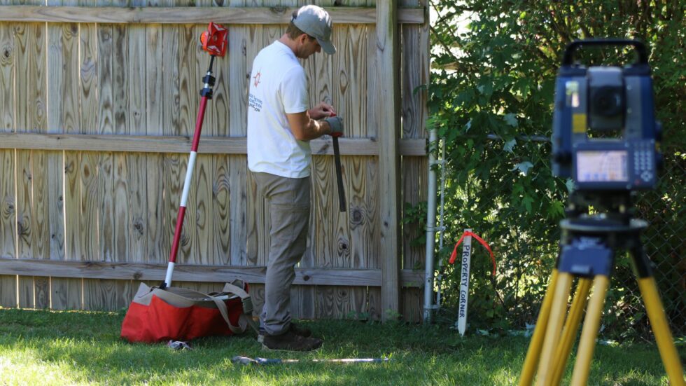
Buying or selling property, subdividing land, constructing fences and other improvements, or resolving boundary disputes; Using a combination of deed research and on-site field observations, Unger Surveying & Construction produces accurate determination of property lines. Let us know, we are happy to discuss the best course of action for your project. All quotes are fee.
Land Surveying &
Topography Mapping Services
Boundary and Property Line Surveys
Delineation of property boundaries through field survey and property deed research.
ALTA / NSPS Land Title Surveys
Delineation of existing site features and conditions to appease the needs of lenders and title companies when proposing commercial land development or sales.
Topographic Surveys
Delineation of existing property features, elevations, and conditions through land surveying.
Location Drawings
Residential survey showing house, garages, sheds, and other site features on and near the property in relationship to property line boundaries.
Subdivision and Condominium Plats
Subdivision plat is created when the owner(s) of a property decide they want to separate their land into smaller areas of land called lots or parcels. Condominium plat is a survey description and map of a condominium interest in a structure for the purposes of conveying title.
Right of Way Easements and Utility Easements
Knowing the location of easements and rights-of-way is vitally important for property owners who intend to add improvements to their property. Unger Surveying & Construction provides accurate documentation of these important property features to help landowners conform to the appropriate local and state regulations.
Lot Consolidation
Lot consolidation is utilized to combine multiple lots or parcels to create one lot.
Meet and Bounds Descriptions
A Legal Description starts from a point of beginning, then traces the outline of the property’s boundary lines until there is closure.
Construction Layout / Stakeout
Construction efficiency is always easier to achieve when design or proposed features are clearly and correctly marked in the field through an accurate survey.
Build Grid Line Controls
Whether you are establishing Grid Lines at ground level or on the 15th floor, Unger Surveying & Construction maintain the highest level of precision and accuracy.
As-Built Surveys
Typically performed after construction, these surveys note the improvements made to a property.
Deformation Monitoring
Deformation surveys can be used to measure the amount by which a structure moves both vertically and horizontally over regular time intervals. Enabling sites to reduce risk and improve safety for workers.
Pool Certifications
Precise and accuracy measurement for U.S. Swim pool certifications.
Pre-Construction Reports
Before excavation commences, a pre-construction report details existing site features near the limits of disturbance.
FEMA Elevation Certifications
Delineation of existing floodplain in relation to existing structures.
Benchmarks
Vertical control points for site construction reference.